Race bulletin
Provisional results: Click here to view the provisional results
Race format / Race information
- Map available on Livelox after the race:

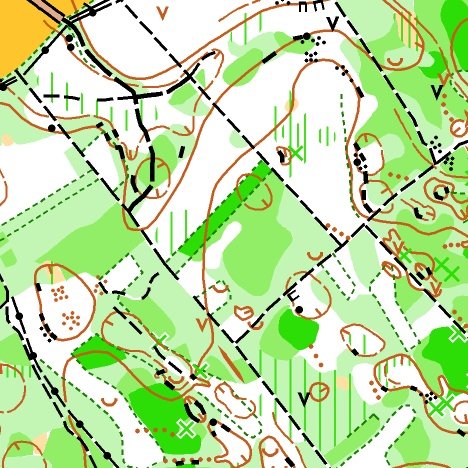
SCALES:
1:10000
1:7500
CARTOGRAPHERS:
RUI ANTUNES
JOSE MANUEL GALVEZ
COURSE PLANNER:
DANIEL PAPILLON
CONTROLLER:
VALENTIN CHAREYRE
REFEREE:
MATHIEU HARNIST
FEDERAL DELEGATE:
DENIS GENEVES
RECEPTION:
AT THE ARENA FROM 8:00
FIRST START:
9:30
COURSES CLOSE:
2 HOURS AFTER THE LAST START
Parking – Reception: 0 m
Reception – Start: 700 m
Finish – Reception: 0 m
Distance from the event centre: 5 km
Special instructions / Additional information
Terrain
The low vegetation has grown well since the survey work carried out by the cartographers at the end of winter. Some areas are more overgrown than they appear on the map. We recommend running with legs covered.
The race may also be slowed down on old forest tracks covered by tall grass or brambles.
Technical information
- Forest area with moderate climb. The forest is heavily worked and has a dense network of forest roads and rides.
- Very varied vegetation: very runnable undergrowth in fir stands; recent clear-cuts or selective cuts are often cluttered with low vegetation.
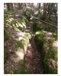
- Rocky areas on about half of the map do not greatly affect running speed. In these sectors, rocky cracks of varying length and depth between 0.5 m and 2 m. Please be careful. No danger for the shortest courses that do not cross these areas.
- Presence of a few low stone walls which may be hard to spot in places.
Specific legend
-
 Rock crack
- Uprooted tree stump or cut tree with a high, not uprooted stump may also be shown with the triangle symbol.
Embargoed areas
Information regarding embargoed areas and zones forbidden for reconnaissance is available on the French Orienteering Federation website. Participants must comply with these restrictions.